SPICA e-Navigator
SPICA e-Navigator is a sophisticated passage planning marine software solution that aids in digital navigation. SPICA is the perfect software complement for SOLAS class vessels sailing digitally with ECDIS. It is a back of bridge system designed to make compliance with SOLAS Chapter V navigation requirements easy and simple for vessels and shipping companies. You can get the needed industry standard S-57/S-63 electronic navigation chart (ENC) data by simply entering the transited ports for a voyage, the software does the rest.
E-NAVIGATION MADE SIMPLE
The intelligent software provides individual vessels unique control of each voyage and promotes greater fleet optimization through improved passage planning, monitoring, analysis and communication capabilities.
(click to enlarge)
QUICK VIEW
FEATURES
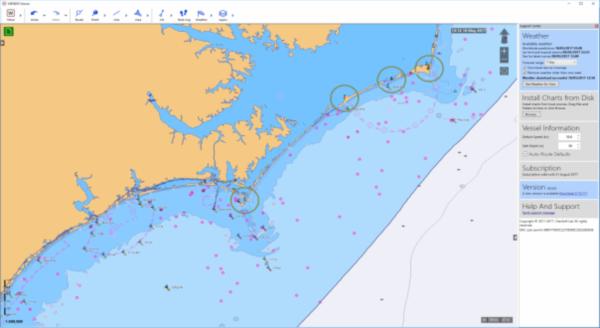
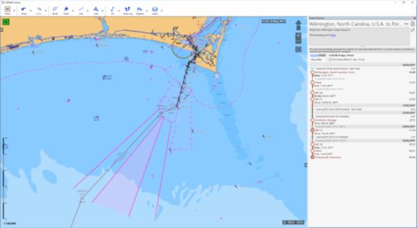
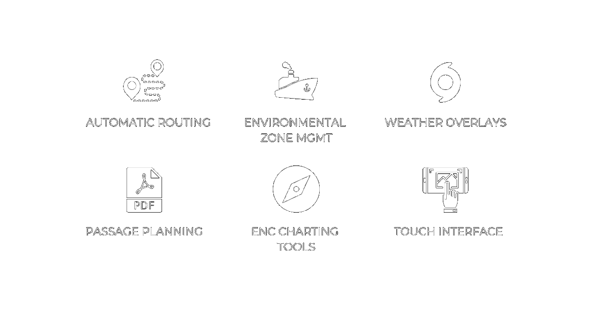
- Automatically generate accurate routes – you input the port, SPICA generates your path
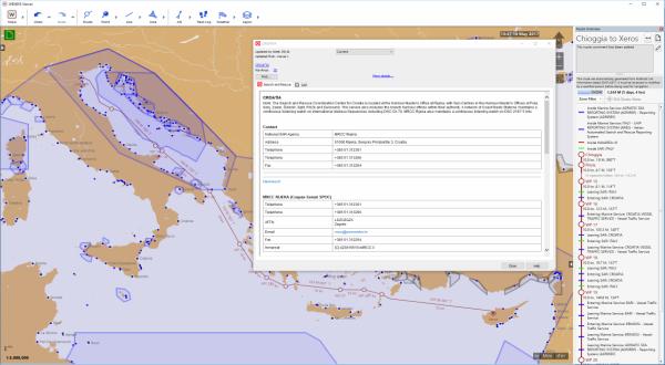
- Overlay the chart with Tides and Radio Signals data that is drawn directly from other ADMIRALTY Digital Products
- Intuitive, easy-to-use components – designed with a simple, touch-friendly user interface
- Sequential, instantaneous downloads and displays of any ENC charts in an organized format
- Integrated AIO, AENP, ADP and ECA zone management.
- Route monitoring. GPS and AIS inputs. Helming display, ETA, etc.
- Manage routes and overlays; calculate departure times, arrival times, and leg speeds with a simple click
- Highly detailed charts featuring overlay points, lines, areas, annotations, and visual routing
- SPICA overlay management allows route data to be exchanged with the ECDIS and export route reports for passage plans
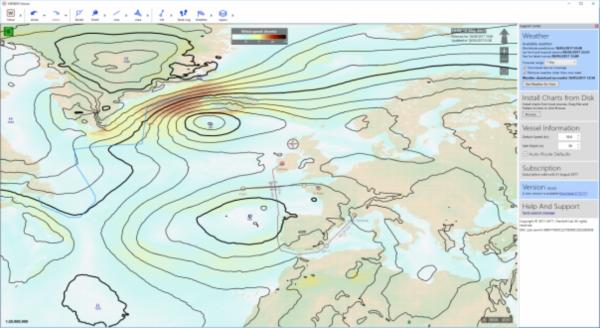
- Download data directly from Vento Maritime, on demand – to give you comprehensive weather overlays, including: sea state, wind, water currents, pressure, sea ice, and typhoons
- The software can be linked to AIS and GPS receivers.
- Automatically generate accurate routes – you input the port, SPICA generates your path
- Overlay the chart with Tides and Radio Signals data that is drawn directly from other ADMIRALTY Digital Products
- Intuitive, easy-to-use components – designed with a simple, touch-friendly user interface
- Sequential, instantaneous downloads and displays of any ENC charts in an organized format
- Integrated AIO, AENP, ADP and ECA zone management.
- Route monitoring. GPS and AIS inputs. Helming display, ETA, etc.
- Manage routes and overlays; calculate departure times, arrival times, and leg speeds with a simple click
- Highly detailed charts featuring overlay points, lines, areas, annotations, and visual routing
- SPICA overlay management allows route data to be exchanged with the ECDIS and export route reports for passage plans
- Download data directly from Vento Maritime, on demand – to give you comprehensive weather overlays, including: sea state, wind, water currents, pressure, sea ice, and typhoons
- The software can be linked to AIS and GPS receivers.
INTEGRATION ABILITIES


REQUEST A DEMO
SINGLE VESSEL DEMO
MANAGEMENT DEMO
SPICA is a product of American Nautical Services, Inc.
Be sure to take a look at our Terms of Use | Privacy Policy | Support

American Nautical Services, Inc.
3311 S Andrews Ave, Suite 11
Fort Lauderdale, FL 33316
United States of America